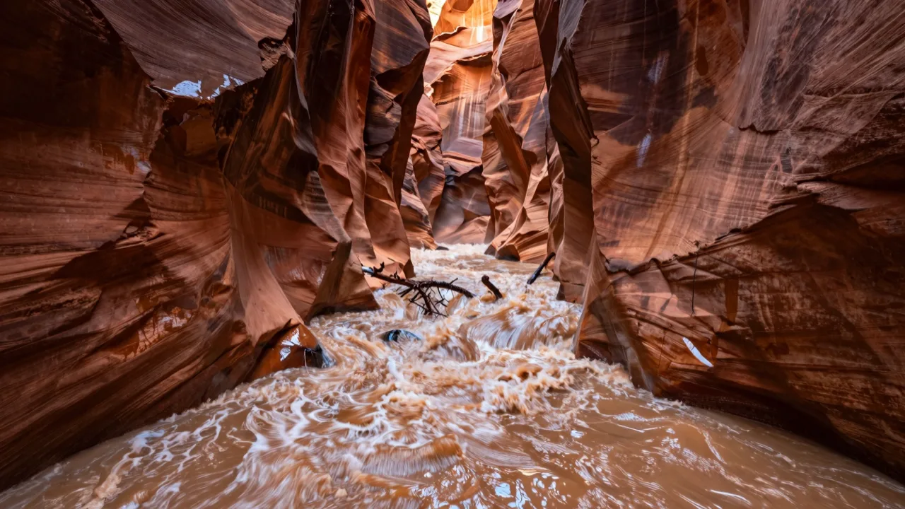
Zion National Park flooding: what is actually closed right now
If you are looking up Zion National Park flooding, you want a straight answer to one question: is the park open, and will the hike I planned still happen? The realistic answer is that Zion almost never shuts down entirely. What shuts down, sometimes within minutes, are the specific places where water gathers and moves fast: The Narrows, the technical slot canyons, low river crossings, and occasionally the highway through Springdale when mud and rock slide onto the road. A flash flood in southern Utah does not need rain over your head. A thunderstorm sitting thirty miles upstream over the Virgin River drainage can send a brown wall of water down a canyon that looks perfectly sunny, which is why viral footage of flash flooding in Nepal looks unbelievable to people who have never stood between two walls of rock.
The Narrows and the 150 cfs rule
The single most useful number for a Zion trip is the flow of the North Fork of the Virgin River, measured in cubic feet per second at the gauge above the park. The long standing park rule is that The Narrows closes to hikers when that flow reaches roughly 150 cubic feet per second, and reopens once it drops back below and the water clears. That number matters far more than the sky above your hotel. During a monsoon storm the river can jump from a walkable trickle to several hundred cfs within an hour, then take a day or two to settle. Silty brown water is its own warning, because you cannot see your footing. Rangers post the reading and the closure status daily, much the way independent forecasters who translate radar into plain language became the trusted voice during Gulf storms.
The daily flash flood potential rating
Zion publishes a flash flood potential rating each morning, built with National Weather Service input and running from not expected through possible and probable up to expected. Probable or expected means canyoneering permits are usually voided and the narrow routes are off, no debate. Possible is the tricky one, because the park hands the decision back to you. Treat possible as a hard no if your route has no exit for a mile or more. Checking that rating before you leave the trailhead is the habit that separates a good trip from a rescue, the same discipline that protects visitors when smoke and fire closures sweep through Washington State.
Which parts of the park flood, and what happens to the roads
Zion Canyon takes the visible hit: the Riverside Walk, the Temple of Sinawava area, the Pa'rus Trail and riverside picnic spots can go under. Kolob Canyons and Kolob Terrace Road, higher and further north, tend to close for slides and washouts rather than standing water. State Route 9 through Springdale is the lifeline, and when debris shuts it the gateway town fills fast, every table at the local mountain town coffee house included, the way a regional storm around Houston rearranges a whole week of plans. Big regional events have triggered county and state emergency declarations before, the kind that unlock aid similar to state disaster relief programs elsewhere.
Refunds, permits and the shuttle: what you can get back
Entrance fees are charged per vehicle for seven days and are not refunded for weather. Angels Landing lottery application fees are not refunded either, and a permit you cannot use because the trail closed does not usually convert to another date. Wilderness and canyoneering permits are the exception: when the park voids them for flood danger it normally issues a refund or credit, so keep your confirmation. The free shuttle keeps running in most weather and stops only for road damage or lightning, and anyone who has used a big park and ride shuttle operation already knows the rhythm. Lodging and guided tour refunds depend entirely on the operator storm policy, so read it before booking.
If you are caught in rising water
Move up, not out. Climbing even ten feet above the channel beats trying to outrun water, because a flood front moves faster than anyone walks on wet rock. Do not cross moving water above your knees. Wait it out, since most surges pass within the hour. In September 2015, seven canyoneers died in a flash flood in Keyhole Canyon on a day when most of the rain fell outside the park, and that remains the reference point for how fast conditions turn.
If the storm wins the day
Dogs are allowed only on the Pa'rus Trail, and boarding fills quickly during storm days, the same crunch animal shelters and rescue groups see whenever a region floods. For a washed out afternoon, a roadside zoo visitor guide style stop, a giant screen theater matinee in the nearest city, or an indoor hour with TedsWoodworking step by step plans for the backyard shelter you keep postponing beats sitting in a parked car watching the river rise.
Planning around the monsoon
The wet window runs from roughly mid July into late September, with storms building in the early afternoon. Start at dawn, be out of narrow ground by noon, and you dodge most of it. October into early November and April into May are the calmer bets, and locking those dates early deserves the same attention people give to peak bloom timing for the Washington DC cherry trees. Heat is the other half of the equation: anyone who has followed the Badwater 135 ultramarathon through Death Valley knows how fast dehydration compounds a bad call, and what a strength and conditioning coach teaches about training for long days applies double on wet boulders. Some travelers pick dates using a Year of the Horse 2026 guide to lucky travel timing, while hikers watching their energy on ten hour approaches compare Gluco6 reviews for steady blood sugar support during long exertion. At toughestblogger we track these closures like any fast moving story, and the pattern repeats every summer: the park stays open, and the water decides the rest.
People also ask
Is Zion National Park closed because of flooding?
The whole park closing is rare. Individual areas close instead: The Narrows, technical slot canyons, riverside trails and sometimes State Route 9 for debris. Check the park alerts page and the daily flash flood potential rating the morning you plan to hike, not the night before.
At what water level does The Narrows close?
The park has long used a threshold near 150 cubic feet per second on the North Fork of the Virgin River. Above that the hike closes, and it reopens when flow drops back down and the water clears enough to see your footing.
Do I get a refund if flooding cancels my Zion hike?
Entrance fees and Angels Landing lottery application fees are not refunded for weather. Wilderness and canyoneering permits voided by the park for flood danger are normally refunded or credited, so keep your confirmation. Lodging and tour refunds follow each operator own policy.
When is flash flood season at Zion?
Roughly mid July through late September, the North American monsoon period, with storms typically building in the early afternoon. Spring runoff can also raise the river in April and May, which affects The Narrows even on clear days.
What should I do if a flash flood starts while I am in a canyon?
Climb to higher ground immediately rather than trying to outrun the water, avoid crossing moving water above knee depth, and wait until the surge passes, which is usually less than an hour. Tell someone your route before you start, since cell service is unreliable.